A high-altitude plateau where no trees grow. The place where the Changpa herders live. A dry and hostile place. A barren land with shrinking pastures. A frozen frontier. Where the kiang roam. These are just some of the various ways people describe Changthang. Much of what gets said about Changthang seems to represent it as a rather dry and desolate place, without much life. This drives a narrative of Changthang being a degraded wasteland that is in need of greening and changing. But how ‘wasted’ is Changthang truly? This blog tries to answer this question through the review of three distinct ways of seeing: first through two through different maps – one from the Indian government, and one from a conservation NGO – and then through the eyes of local residents, the Changpa herders.
Before diving into these different perceptions, we first need to situate Changthang. As seen from Figure 1, Changthang is part of Ladakh, a Union Territory in India, near the international border with Tibet. This is as far as I can go with my map making skills. As a conservation scientist, I was intrigued to understand how different stakeholders perceive the Changthang landscape. So here goes:
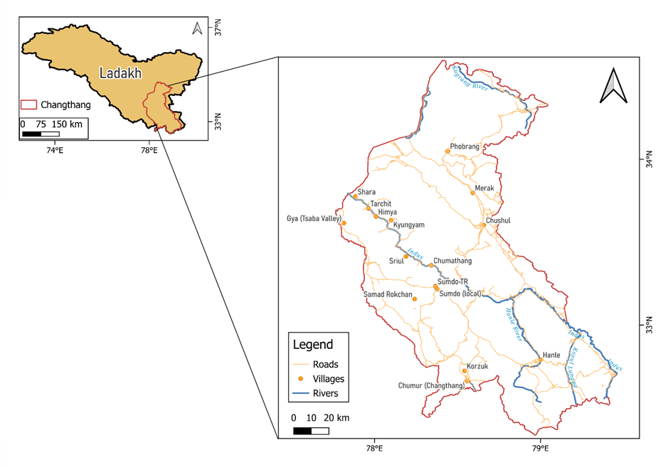
Fig. 1. Map depicting Changthang’s location. Note all boundaries are merely representation and may not be exact demarcation on the ground.
First way of seeing: The Indian Government’s mapping expert As I knocked on the door and finally spoke to the government official, after waiting for ages in the lobby of the government mapping expert, Figure 2 is what I got from them. Apparently, it is published in the Wasteland Atlas of India (now updated). Now beside the point that I found it incredibly hard to understand if the vast areas of pink on the map are “barren rocky area”, or “land affected by salinity” or “gullied or ravenous land” (see legend), two things caught my eyes: first, that the report of this map mentions that nearly 500 sq.km. within this area is a wasteland – i.e. worth nothing, as I understand it, and second, that Changthang is a rather homogenous area consisting of either snow, salty or barren ground.
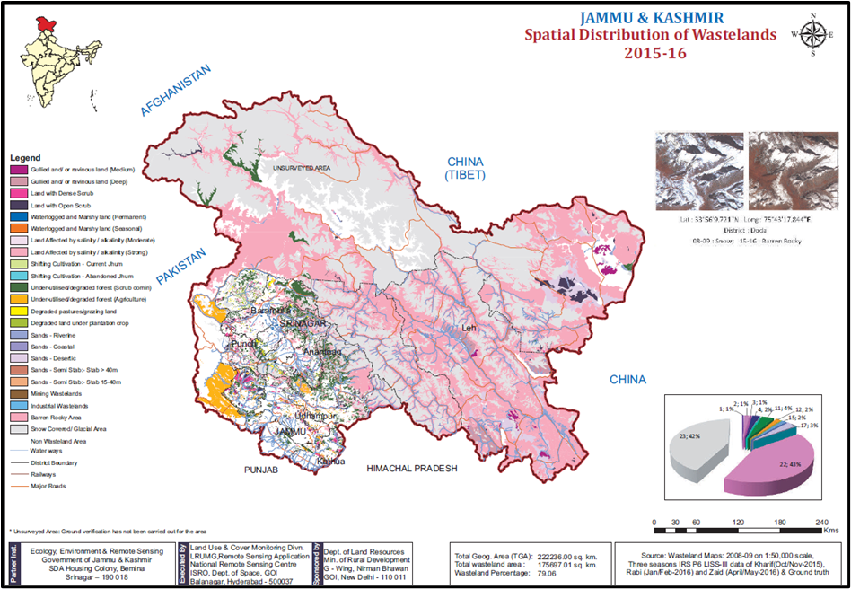
Fig. 2 The “Wasteland” map of J&K state (which Changthang was part of at the time of making this map). Taken from the Wasteland Atlas of India
To me this is a rather unsatisfying way of seeing Changthang, as from my experiences there, Changthang’s habitat are far more diverse than what this map suggests them to be. So, on to the second way of seeing:
Second way of seeing: The mapping expert in a local NGO After months of ground truthing different potential habitats in Changthang, and through reviewing the latest satellite imagery, the mapping expert produced the map in Figure 3. Firstly, what was really interesting about this map was that unlike the one from the government, the ground work to understand habitat revealed that there were at least seven different land cover types in Changthang. However, quickly as you can see already from these maps as well, when median values are considered (left map) rather than mean values (right map) for composite satellite imagery of various land classes, the output of the same landscape with the same input data is vastly different. This is the case because when one builds a composite in Google Earth Engine (the platform for analysis for this work) for a chosen time period, the mean takes the average reflectance of each pixel across all images in that time range, while the median takes the middle value, which is less affected by clouds, haze, or extreme outliers. Google Earth Engine often uses median composites because they are more robust against noise and produce a cleaner, more representative image for LULC classification. Likewise, the expert told me, all online tutorials and papers suggest to take the median value of composite satellite imagery for a given land class. But then if you look at the map on the left, one wonders: how can bog meadows suddenly pop up in the middle of large lakes? To answer this question, we need to ask the local land experts of of Changthang, the Changpa herders.
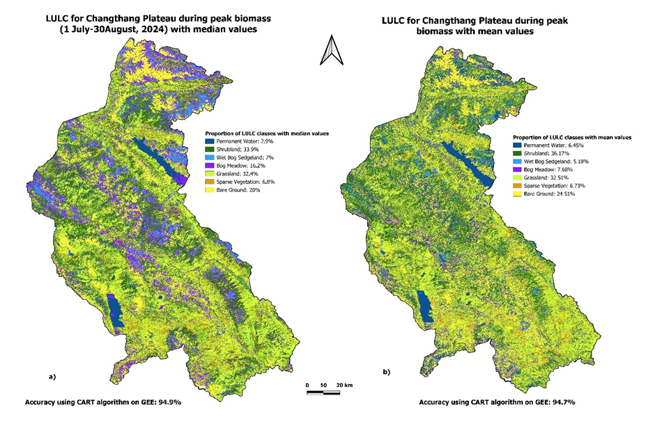
Fig. 3. Maps showing theland cover information about Changthang
Third way of seeing: The Changpa herders of Changthang
Map making here is a relatively alien concept, so when the Changpa herders looked at the above maps (fig. 3) they found it hard to grasp concepts such as a bog meadow or a wetland – which to me, a conservation scientist, seem like perfectly well-defined land cover categories describing the landscape of Changthang. To Changpa herders bog meadows and wetlands are not distinct classes but rather temporary variants of its key components – land and water. These temporary variants are defined as ‘Spung’, ‘Poto’, and ‘Khilchu’. Spung are areas where large grass and herbs dominate, but as soon as the same land becomes a bit moister, it becomes a Poto. If that land is covered with water for a period of time, it becomes a Khilchu. Each of these states can happen to the same piece of land in a year or across years, depending on the weather and seasons of that year. This then changes how the Changpa use these lands. Spung is perfect grazing areas for sheep and goat, Poto a haven for Yaks, and Khilchu is used to collect salts that are fed as supplement to the livestock. So, after reviewing these three ways of seeing, is Changthang wasted after all? Well, if maps are to be trusted, Changthang is, fortunately or unfortunately, whatever you want it to be. Because then Changthang, like any landscape, is more about what data is used, who uses it and what narratives suits the user. For instance, fig. 2 furthers the agenda of the Department of Land Resources within the Ministry of Rural Development to designate vast areas of Changthang as wastelands, because it allows easier access of getting clearances for large energy projects. Alternatively, fig. 3 catches a world view of the local conservationists that attempt to shows that Changthang is not a homogenous waste-good for nothing-land, rather an accumulation of various intricate habitats. This particularly can help to push back against a wave of tree plantation drives that are ongoing here, showing that Changthang is a rich mixture of non-tree habitats. Yet, the best attempts of the conservationist don’t seem to capture the nuance that exists in the views of Changthang by the Changpa herders. To my conservation scientist academic eye, it is clear that Changthang is not a wasteland, even though other views and lenses might disagree.
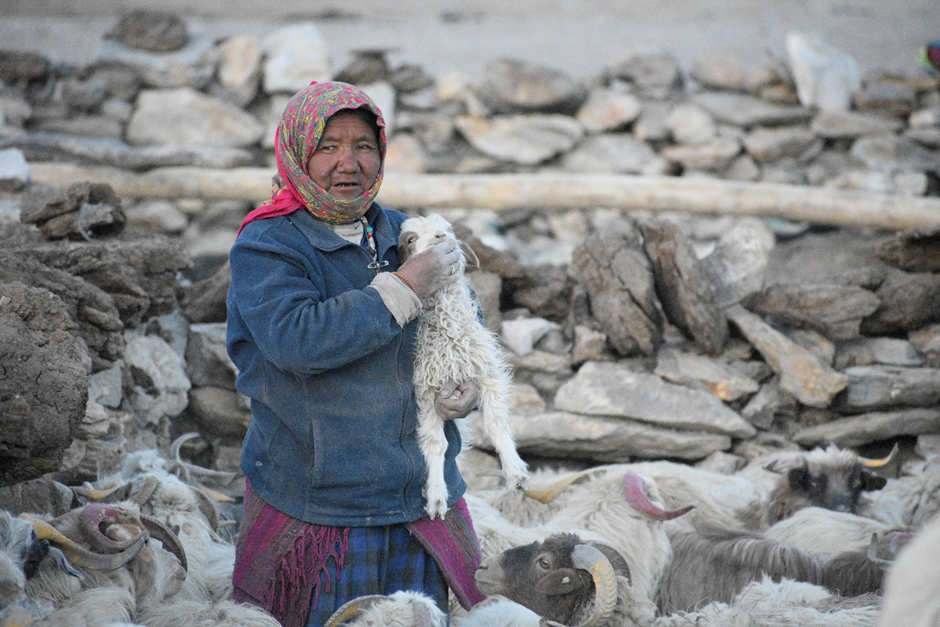
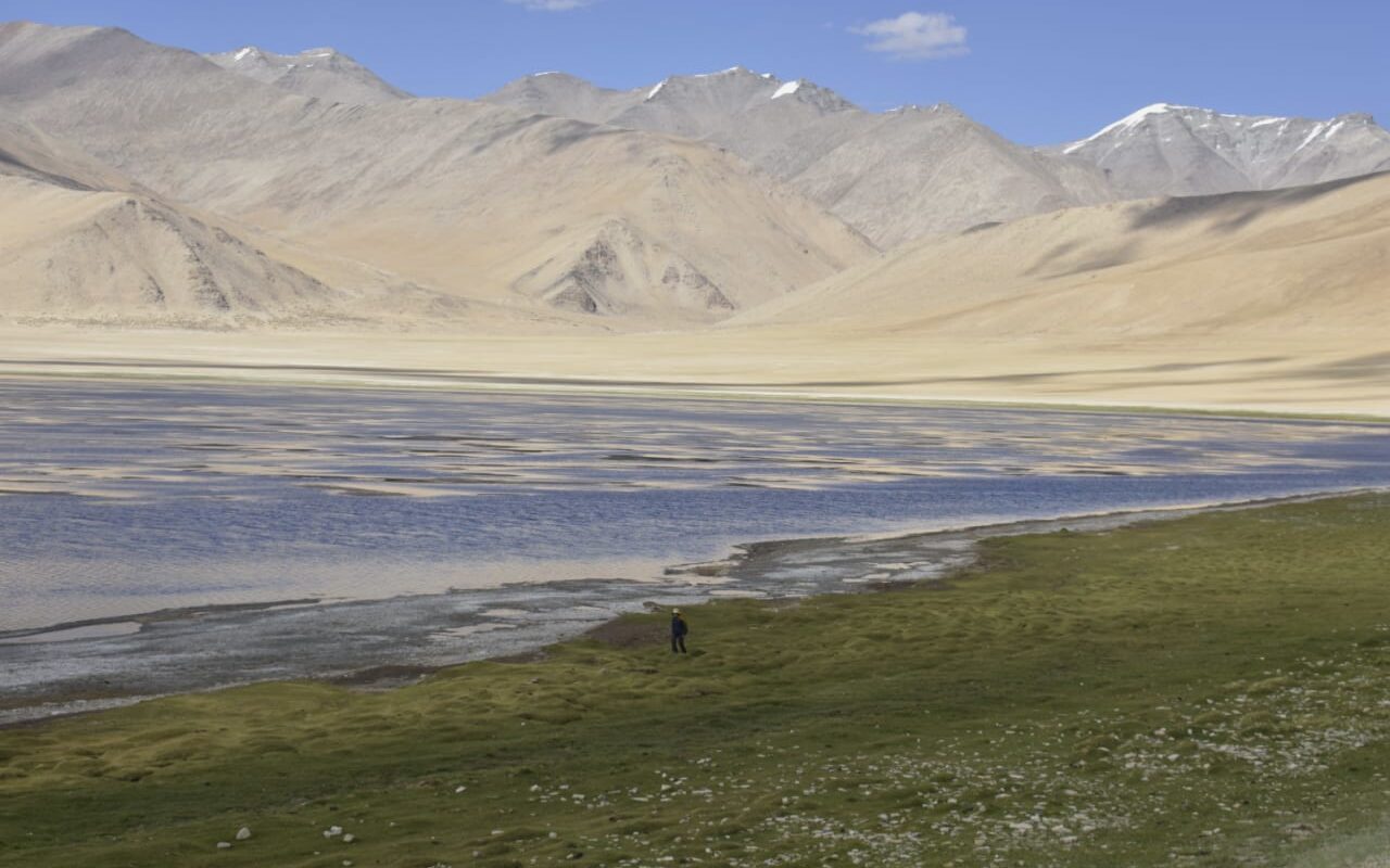
A Changpa herder in Changthang