Last September, Jocelyne, Dan, and Alvaro were very fortunate to host 19 participants at ICTA-UAB for a two-day workshop considering the mapping of Indigenous Peoples’ Lands (IPL). We wanted the workshop to be a space for sharing diverse experiences and perspectives on mapping people-place connections, exploring the benefits and pitfalls of the global map of IPL and its use, and offering ways forward with future mapping efforts. This workshop builds on an earlier meeting with Julia Fa and Stephen Garnett.
Why are we focusing on the Indigenous Peoples’ Lands map?
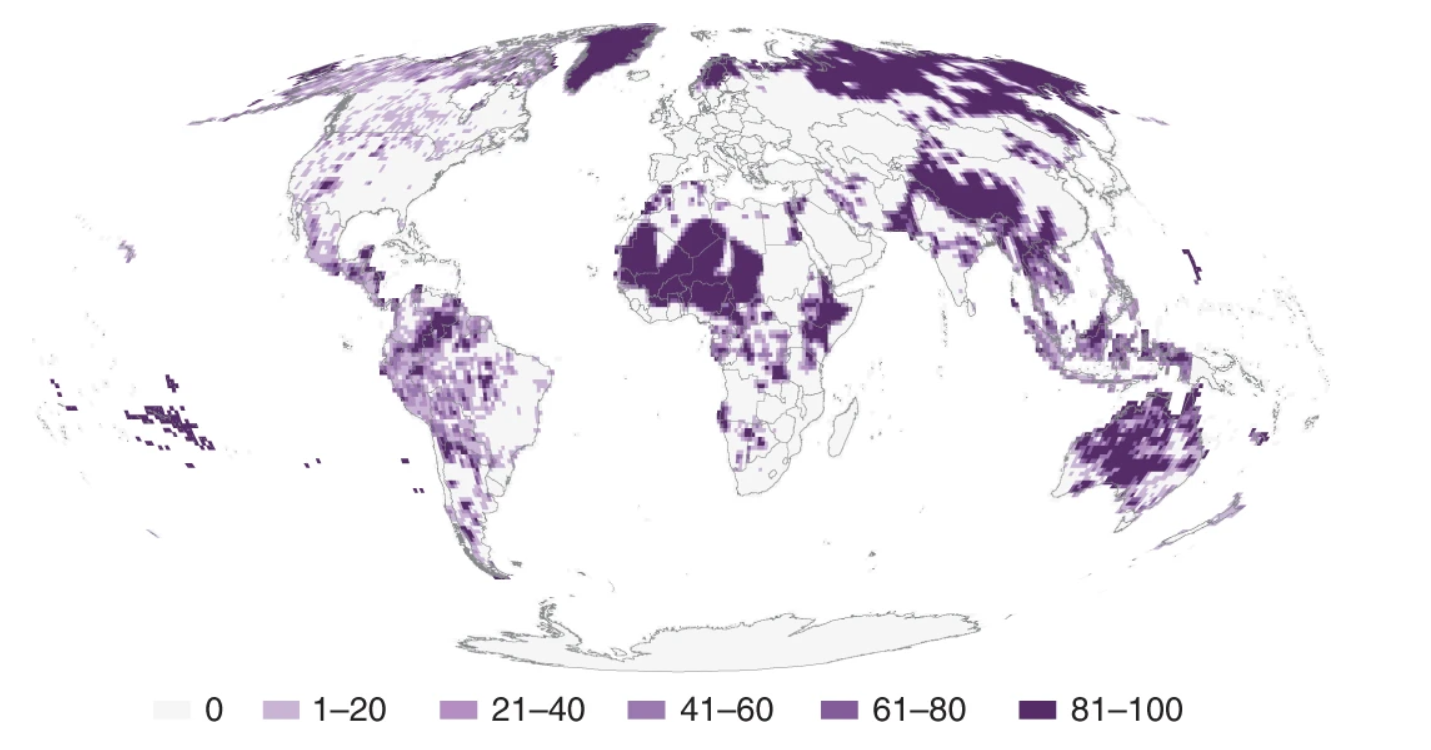
The map produced by Garnett et al. (2018) has been widely used in ecological and conservation science papers and has played an important role in different science-policy forums (such as IPBES and the GBF). As researchers who have worked on, used, or cited the map, we thought this was a good moment to reflect on its implications, its uses in both science and policy, and the roles it has fulfilled.
Who participated in this workshop?
Through recommendations, Jocelyne reached out to people who were engaged on this topic of mapping lands and advancing Indigenous Peoples’ rights in the context of biodiversity conservation. This included scholars and community rights advocates from various geographies and landscapes, Indigenous and non-Indigenous peoples. A common interest binding us is a firm commitment to support and strengthen rights of people particularly within conservation spaces. While some people were able to join in person for the workshop, others engaged in conversations before and after the workshop. The report (available below) is an output from those present at the workshop, an effort to provide a compilation of the breadth and depth of views presented, however, it does not necessarily reflect agreed positions or proposals.
How did the workshop proceed?
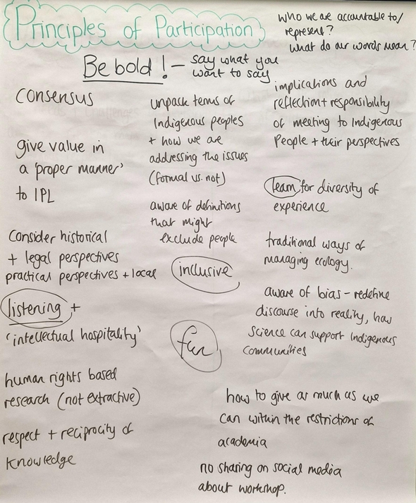
Jessica Ball facilitated our workshop. We started out by situating ourselves in Barcelona and acknowledging its colonial history and agreeing on principles and values of participation in this workshop (Figure 1).
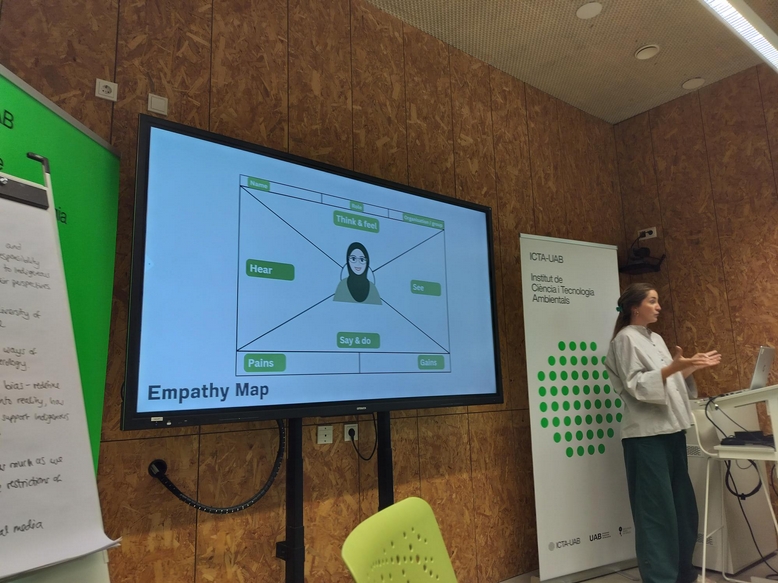
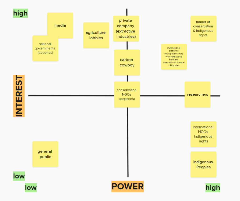
The overarching themes of discussion were informed by earlier conversations that Jocelyne had with diverse interlocuters. On the first day, through the use of Mentimeter and breakout groups, we collectively thought through five possible uses of a global map of Indigenous Peoples’ Lands, using empathy mapping (Figure 2) and power-interest matrix (Figure 3) templates to identify key actors involved, and to understand motivations, relationships, and power dynamics between the actors identified. We ended the day with some delicious Catalan food at Marcs restaurant.
Building on the topics that surfaced on the first day, we had World Cafe method of dialogue around the legal aspects of maps, Indigeneity, conceptual and procedural considerations, and social contexts of map use. These were guided by questions around the needs and challenges of revising, or even creating new maps of Indigenous Peoples’ Lands and Seas, salient issues associated with uses of existing maps, and the dangers related to an absence of maps. The discussions provided the critical input for the writing of the report, which was drafted as part of a collaborative writing process in subgroups.
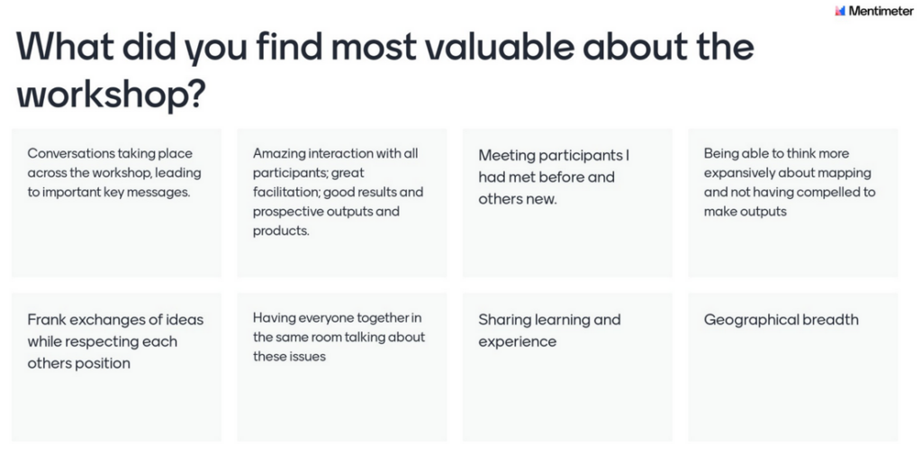
We ended the workshop with personal and group reflections on what was most valuable about our time together and how things could have been done differently (Figure 4). Overall, it was generally agreed that the workshop had been a useful gathering to share and consolidate learnings on this important topic.
What are the main takeaways from the workshop?
- Maps are powerful tools; they are representations that reflect the ontologies and epistemologies of their creators, and have power to make visible or not. Maps made with the best intentions can still cause harm.
- Maps should be produced for a specific purpose. Its purpose, how it was created, and how it might misrepresent reality should be stated clearly. This helps clarify whose lands are being mapped, why and for which reason.
- The IPL map has had many positive impacts: it has become a lodestone for many subsequent scientific studies that highlight the importance and contributions of Indigenous Peoples, supporting and strengthening narratives around the vital roles of and governance by Indigenous Peoples in biodiversity conservation and climate change mitigation.
- The IPL map, and other similar maps, will always have to contend with the inherent contradictions of maps being unable to adequately represent reality and the dynamism of Indigenous Peoples. Nonetheless, they should always support and strengthen the rights of Indigenous Peoples in and of themselves.
You can find the report from our workshop below.